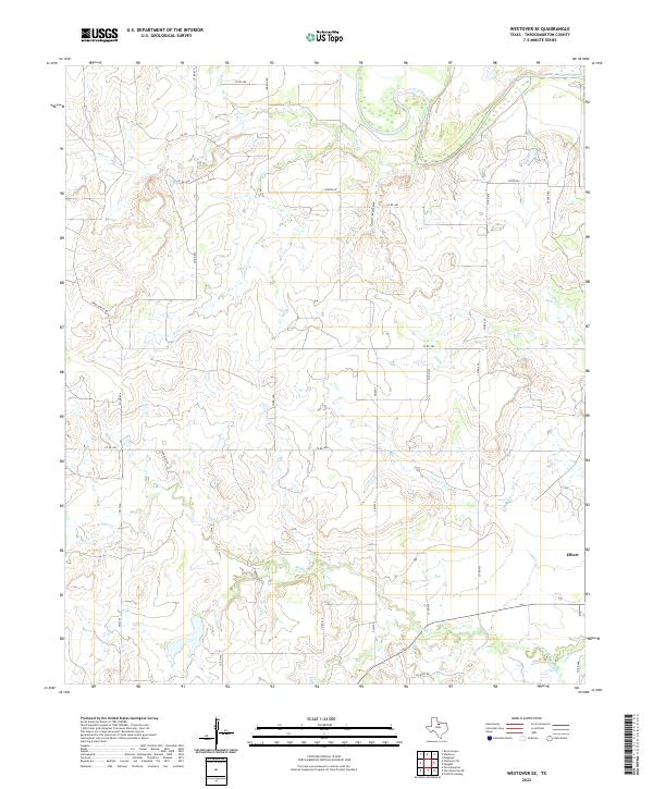
2022 Map of Westover SE
USGS Topo · Published 2022About this map
Elbert sits near the eastern edge of this Throckmorton County landscape, where the prairie begins to break toward the winding path of the Brazos River. This 2022 survey captures a rural Texas expanse defined by its drainage networks, including the seasonal flow of Hog Cr in the north and the expansive reach of Boggy Cr across the south. The terrain is marked by distinctive natural features like Coon Hollow and the drainage of Leopard Cr, reflecting a ranching and agricultural economy that relies on the natural contours of the land. A network of country roads, including the aptly named Oil Rd and Spade Ranch Rd, links isolated homesteads and work sites to the larger region, providing a modern view of how these remote North Texas settlements continue to operate within the state's traditional ranching corridors.
Find a feature on this map
28 named features on this map. Tap any name to fly to it.
Don’t see what you’re looking for? This feature index may not catch every label — zoom into the map to look around manually.
Map Details
Editions of this 2022 Westover SE Map
This is the sole edition of this map. No revisions or reprints were ever made.
Other maps of this area

1954 · Wichita Falls
USGS Topo · 1:250,000

1958 · Wichita Falls
USGS Topo · 1:250,000

1963 · Megargel
USGS Topo · 1:24,000

1964 · Padgett
USGS Topo · 1:24,000

1965 · Throckmorton NE
USGS Topo · 1:24,000

1966 · Westover SE
USGS Topo · 1:24,000

1966 · Rock Canyon
USGS Topo · 1:24,000

1966 · Westover SW
USGS Topo · 1:24,000
1966 · Throckmorton
USGS Topo · 1:24,000
1966 · Westover
USGS Topo · 1:24,000