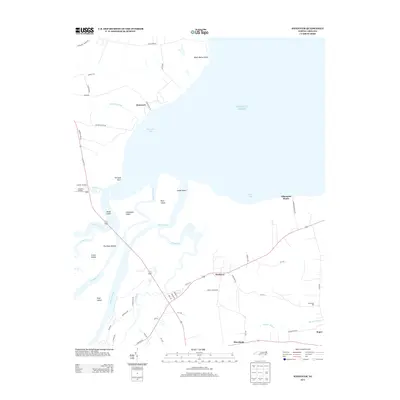
2013 Map of Westover
USGS Topo · Published 2013About this map
Roanoke River and Eastmost River define the intricate hydrological landscape of this coastal region, where numerous landforms such as Purchase Islands, Rice Island, and Great Island separate the river channels from the open waters of Batchelor Bay. Small settlements and landings punctuate the shoreline and interior, including Cashoke Landing, Elmwood, and the coastal reach at Albemarle Beach. Inland, the community of Westover serves as a crossroads near Buncombe Hall, while the southern edge of the survey transitions toward the town of Roper. The map documents a complex network of local roads like Peterson Church Rd and Mackeys Rd that navigate the marshy margins of Morgan Swamp and the tributaries of Conaby Cr, illustrating the long-standing relationship between the region's residents and its extensive waterways.
Find a feature on this map
60 named features on this map. Tap any name to fly to it.
Don’t see what you’re looking for? This feature index may not catch every label — zoom into the map to look around manually.
Map Details
Editions of this 2013 Westover Map
This is the sole edition of this map. No revisions or reprints were ever made.
Other maps of this area

1904 · Edenton
USGS Topo · 1:62,500

1942 · Edenton
USGS Topo · 1:62,500

1943 · Plymouth
USGS Topo · 1:125,000

1943 · Edenton
USGS Topo · 1:62,500

1953 · Norfolk
USGS Topo · 1:250,000

1953 · Rocky Mount
USGS Topo · 1:250,000

1954 · Rocky Mount
USGS Topo · 1:250,000

1954 · Plymouth East
USGS Topo · 1:24,000

1954 · Roper North
USGS Topo · 1:24,000

1954 · Roper South
USGS Topo · 1:24,000