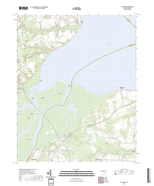
2022 Map of Westover
USGS Topo · Published 2022About this map
Albemarle Sound dominates the northern horizon of this coastal landscape where the Roanoke River and Cashie River converge into Batchelor Bay. The intricate delta network is defined by numerous landmasses including Great Island, Rice Island, and Goodmans Island, separated by the Eastmost River and Middle River. This environment has historically dictated the movement of goods and people across Washington, Bertie, and Chowan counties, with water bodies like Conaby Creek and Morgan Swamp shaping the available farmland.
Find a feature on this map
59 named features on this map. Tap any name to fly to it.
Don’t see what you’re looking for? This feature index may not catch every label — zoom into the map to look around manually.
Map Details
Editions of this 2022 Westover Map
This is the sole edition of this map. No revisions or reprints were ever made.
Other maps of this area

1904 · Edenton
USGS Topo · 1:62,500

1942 · Edenton
USGS Topo · 1:62,500

1943 · Plymouth
USGS Topo · 1:125,000

1943 · Edenton
USGS Topo · 1:62,500

1953 · Norfolk
USGS Topo · 1:250,000

1953 · Rocky Mount
USGS Topo · 1:250,000

1954 · Rocky Mount
USGS Topo · 1:250,000

1954 · Plymouth East
USGS Topo · 1:24,000

1954 · Roper North
USGS Topo · 1:24,000

1954 · Roper South
USGS Topo · 1:24,000