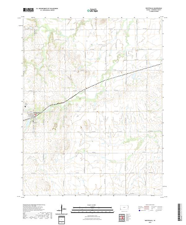
2022 Map of Westphalia
USGS Topo · Published 2022About this map
Westphalia anchors this section of Anderson County, situated at the intersection of a precise grid of rural routes. The town’s local history is anchored by Saint Teresa's Cem to the west and the Westphalia City Cem to the south, marking the community's established roots in the landscape. The surrounding terrain is defined by a dense network of watercourses, including Pottawatomie Cr and Cherry Cr, which carve through the agricultural blocks. Further east, Spencer Lake provides a localized landmark amidst the square-mile sections of T21S and T22S. This survey shows the modern persistence of the Public Land Survey System, where roads like NW 1500 RD and SW Arkansas RD strictly adhere to township and range boundaries, illustrating how early nineteenth-century land division continues to dictate the spatial organization of Kansas farming communities.
Find a feature on this map
41 named features on this map. Tap any name to fly to it.
Don’t see what you’re looking for? This feature index may not catch every label — zoom into the map to look around manually.
Map Details
Editions of this 2022 Westphalia Map
This is the sole edition of this map. No revisions or reprints were ever made.
Other maps of this area

1885 · Burlington
USGS Topo · 1:125,000

1885 · Garnett
USGS Topo · 1:125,000

1894 · Garnett
USGS Topo · 1:125,000

1894 · Burlington
USGS Topo · 1:125,000

1947 · Lawrence
USGS Topo · 1:250,000

1950 · Lawrence
USGS Topo · 1:250,000

1956 · Lawrence
USGS Topo · 1:250,000

1961 · Lawrence
USGS Topo · 1:250,000
1966 · Westphalia
USGS Topo · 1:24,000
1966 · Welda
USGS Topo · 1:24,000