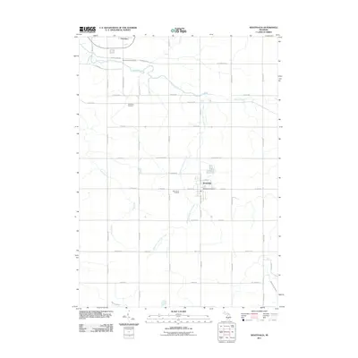
2011 Map of Westphalia
USGS Topo · Published 2011About this map
Westphalia stands as a central community in this agricultural landscape of Clinton County, organized around a rigid grid of rural roads and the local Westphalia Post Office. The village layout is concentrated near the intersection of W Main St and S Westphalia St, reflecting a traditional Midwestern settlement pattern. To the northwest, the edge of Pewamo is visible, while the rest of the quadrangle is defined by scattered farmsteads and family-linked landmarks. These include Saint Marys Cemetery, Mount Calvary Cemetery, and Spaulding Cemetery, which provide critical points of interest for genealogical research in Westphalia Township. The terrain is drained by a network of small waterways, most notably the winding Stony Creek and the uniquely named Kloeckner and Fuller Creek, which cuts diagonally across the southern agricultural blocks. The map preserves a detailed view of the rural infrastructure at the start of the 2010s, from the E David Hwy corridor to remote sections along Derbyshire Lee Branch.
Find a feature on this map
48 named features on this map. Tap any name to fly to it.
Don’t see what you’re looking for? This feature index may not catch every label — zoom into the map to look around manually.
Map Details
Editions of this 2011 Westphalia Map
This is the sole edition of this map. No revisions or reprints were ever made.
Other maps of this area

1918 · Perrinton
USGS Topo · 1:62,500

1927 · De Witt
USGS Topo · 1:62,500

1943 · Perrinton
USGS Topo · 1:62,500

1945 · Portland
USGS Topo · 1:62,500

1954 · Midland
USGS Topo · 1:250,000

1958 · Midland
USGS Topo · 1:250,000

1958 · Grand Rapids
USGS Topo · 1:250,000

1959 · Midland
USGS Topo · 1:250,000

1961 · Grand Rapids
USGS Topo · 1:250,000

1962 · Grand Rapids
USGS Topo · 1:250,000