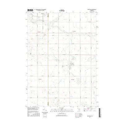
2017 Map of Westphalia
USGS Topo · Published 2017About this map
Westphalia and Pewamo anchor this portrait of the central Michigan agricultural landscape along the border of Ionia and Clinton counties. The village of Westphalia serves as a focal point, characterized by its grid of streets such as W Main St and S Westphalia St, and the prominent Saint Marys Cem. The surrounding countryside is defined by an intricate network of drainage systems essential to local farming, including the Wieber Drain, Gross and Taylor Drain, and the Clinton and Ionia Drain.
Find a feature on this map
71 named features on this map. Tap any name to fly to it.
Don’t see what you’re looking for? This feature index may not catch every label — zoom into the map to look around manually.
Map Details
Editions of this 2017 Westphalia Map
This is the sole edition of this map. No revisions or reprints were ever made.
Other maps of this area

1918 · Perrinton
USGS Topo · 1:62,500

1927 · De Witt
USGS Topo · 1:62,500

1943 · Perrinton
USGS Topo · 1:62,500

1945 · Portland
USGS Topo · 1:62,500

1954 · Midland
USGS Topo · 1:250,000

1958 · Midland
USGS Topo · 1:250,000

1958 · Grand Rapids
USGS Topo · 1:250,000

1959 · Midland
USGS Topo · 1:250,000

1961 · Grand Rapids
USGS Topo · 1:250,000

1962 · Grand Rapids
USGS Topo · 1:250,000