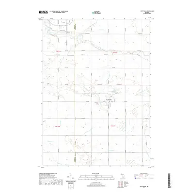
2019 Map of Westphalia
USGS Topo · Published 2019About this map
Westphalia and the northern village of Pewamo anchor this 2019 survey of the rural landscape straddling the Ionia and Clinton county line. The region is defined by a dense network of agricultural waterways, including the Wieber Drain, Gross and Taylor Drain, and the Clinton and Ionia Drain, which channel water toward Stony Creek and Goose Creek. This modern cartographic record captures the persistent grid of section roads and the preservation of communal heritage sites through several well-maintained grounds. Genealogists can identify key local landmarks such as Saint Marys Cemetery in Westphalia, Mount Calvary Cemetery near Pewamo, and the smaller Spaulding Cem and Maple Corners Cem located further into the township. The layout of the villages against this heavily drained agricultural backdrop illustrates the enduring agrarian character of mid-Michigan in the early 21st century.
Find a feature on this map
72 named features on this map. Tap any name to fly to it.
Don’t see what you’re looking for? This feature index may not catch every label — zoom into the map to look around manually.
Map Details
Editions of this 2019 Westphalia Map
This is the sole edition of this map. No revisions or reprints were ever made.
Other maps of this area

1918 · Perrinton
USGS Topo · 1:62,500

1927 · De Witt
USGS Topo · 1:62,500

1943 · Perrinton
USGS Topo · 1:62,500

1945 · Portland
USGS Topo · 1:62,500

1954 · Midland
USGS Topo · 1:250,000

1958 · Midland
USGS Topo · 1:250,000

1958 · Grand Rapids
USGS Topo · 1:250,000

1959 · Midland
USGS Topo · 1:250,000

1961 · Grand Rapids
USGS Topo · 1:250,000

1962 · Grand Rapids
USGS Topo · 1:250,000