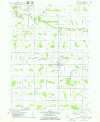
1978 Map of Westphalia
USGS Topo · Published 1979About this map
The village of Westphalia serves as the central hub for this late-1970s agricultural landscape, where the intersection of Kloeckner Road and Price Road defines the local grid. To the northwest, the Grand Trunk Western railroad cuts across the corner of the sheet at Pewamo, reflecting the persistent importance of rail transport for rural Michigan grain centers. This area exhibits a deeply established religious and educational foundation, anchored by St Marys Cem in the heart of town and Mt Calvary Cem to the north, alongside the Pewamo-Westphalia Community Sch.
Find a feature on this map
44 named features on this map. Tap any name to fly to it.
Don’t see what you’re looking for? This feature index may not catch every label — zoom into the map to look around manually.
Map Details
Editions of this 1978 Westphalia Map
This is the sole edition of this map. No revisions or reprints were ever made.
Other maps of this area

1918 · Perrinton
USGS Topo · 1:62,500

1927 · De Witt
USGS Topo · 1:62,500

1943 · Perrinton
USGS Topo · 1:62,500

1945 · Portland
USGS Topo · 1:62,500

1954 · Midland
USGS Topo · 1:250,000

1958 · Midland
USGS Topo · 1:250,000

1958 · Grand Rapids
USGS Topo · 1:250,000

1959 · Midland
USGS Topo · 1:250,000

1961 · Grand Rapids
USGS Topo · 1:250,000

1962 · Grand Rapids
USGS Topo · 1:250,000