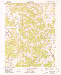
1981 Map of Westphalia East
USGS Topo · Published 1981About this map
The Maries River winds along the western edge of this Osage County landscape, where the settlement of Westphalia is established near the river's bend. The terrain is defined by a dense network of drainages including Loose Creek, Brush Creek, and Indian Creek, which carve through the land between landmarks like Grapevine Hill. This survey highlights the region's mid-century religious and educational centers, specifically Fatima High Sch and the Sacred Heart Cem near Rich Fountain.
Find a feature on this map
29 named features on this map. Tap any name to fly to it.
Don’t see what you’re looking for? This feature index may not catch every label — zoom into the map to look around manually.
Map Details
Editions of this 1981 Westphalia East Map
This is the sole edition of this map. No revisions or reprints were ever made.
Other maps of this area

1886 · Jefferson City
USGS Topo · 1:125,000

1888 · Tuscumbia
USGS Topo · 1:125,000

1890 · Fulton
USGS Topo · 1:125,000

1894 · Tuscumbia
USGS Topo · 1:125,000

1894 · Jefferson City
USGS Topo · 1:125,000

1934 · Linn
USGS Topo · 1:48,000

1939 · Jefferson City
USGS Topo · 1:62,500

1942 · Jefferson City
USGS Topo · 1:62,500

1942 · Linn
USGS Topo · 1:62,500

1945 · Mokane
USGS Topo · 1:62,500