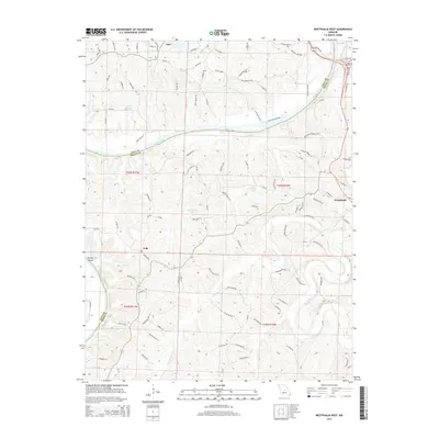
2015 Map of Westphalia West
USGS Topo · Published 2015About this map
The Osage River and Maries River converge in this central Missouri landscape, defining the topography and transport patterns of Cole and Osage Counties. The village of Westphalia anchors the eastern edge of the sheet, while Taos and Folk mark the residential and agricultural centers to the west. The influence of the river system is evident in the naming of local landmarks such as Bloody Island and the presence of specialized infrastructure like Lock and Dam Spur. Local family names and agricultural legacies are preserved in the road network, which includes Bode Ferry Rd and Toebber Ln. Moving away from the larger river valleys, the terrain is dotted with small private water bodies like Baumhoer Lake and Pinnell Lake, illustrating how the land has been managed for local use and irrigation in this rural corridor near the state capital region.
Find a feature on this map
105 named features on this map. Tap any name to fly to it.
Don’t see what you’re looking for? This feature index may not catch every label — zoom into the map to look around manually.
Map Details
Editions of this 2015 Westphalia West Map
This is the sole edition of this map. No revisions or reprints were ever made.
Other maps of this area

1886 · Jefferson City
USGS Topo · 1:125,000

1888 · Tuscumbia
USGS Topo · 1:125,000

1890 · Fulton
USGS Topo · 1:125,000

1894 · Tuscumbia
USGS Topo · 1:125,000

1894 · Jefferson City
USGS Topo · 1:125,000

1934 · Linn
USGS Topo · 1:48,000

1939 · Jefferson City
USGS Topo · 1:24,000

1939 · Jefferson City
USGS Topo · 1:62,500

1942 · Jefferson City
USGS Topo · 1:62,500

1942 · Linn
USGS Topo · 1:62,500