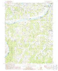
1987 Map of Westphalia West
USGS Topo · Published 1988About this map
The Osage River cuts a wide path through this Missouri landscape, joined by the winding courses of Maries Creek and the Little Maries River. This late-twentieth-century survey documents the transition from the river's industrial past to its natural preservation. Near the northern bend, the presence of Coke Ovens and the Old Lock and Dam (Submerged) point to earlier navigation and coal processing along the waterway. Settlement centers like Westphalia, Taos, and Folk are well-defined, with the Folk Cem providing a specific point of interest for genealogical research. The riverbanks are largely protected within the Mari-Osa State Wildlife Area and Painted Rock State Forest, illustrating a landscape where rugged bluff topography meets managed conservation lands.
Find a feature on this map
20 named features on this map. Tap any name to fly to it.
Don’t see what you’re looking for? This feature index may not catch every label — zoom into the map to look around manually.
Map Details
Editions of this 1987 Westphalia West Map
This is the sole edition of this map. No revisions or reprints were ever made.
Other maps of this area

1886 · Jefferson City
USGS Topo · 1:125,000

1888 · Tuscumbia
USGS Topo · 1:125,000

1890 · Fulton
USGS Topo · 1:125,000

1894 · Tuscumbia
USGS Topo · 1:125,000

1894 · Jefferson City
USGS Topo · 1:125,000

1934 · Linn
USGS Topo · 1:48,000

1939 · Jefferson City
USGS Topo · 1:24,000

1939 · Jefferson City
USGS Topo · 1:62,500

1942 · Jefferson City
USGS Topo · 1:62,500

1942 · Linn
USGS Topo · 1:62,500