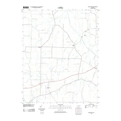
2010 Map of Westplains
USGS Topo · Published 2010About this map
Westplains and Clear Springs anchor this portion of Graves County, where the agricultural landscape is defined by the winding course of the West Fork Clarks River. The terrain features several significant drainage patterns, including Trace Creek, Panther Creek, and the curiously named Pull Tight Branch. Local history is visible in landmarks like the Sand Hill Cemetery and the Old Casey Bridge crossing, which sits near the fertile Casey Bottoms.
Find a feature on this map
64 named features on this map. Tap any name to fly to it.
Don’t see what you’re looking for? This feature index may not catch every label — zoom into the map to look around manually.
Map Details
Editions of this 2010 Westplains Map
This is the sole edition of this map. No revisions or reprints were ever made.
Other maps of this area

1936 · Farmington
USGS Topo · 1:24,000

1936 · Melber
USGS Topo · 1:24,000

1936 · Oak Level
USGS Topo · 1:24,000

1936 · Elva
USGS Topo · 1:24,000

1936 · Symsonia
USGS Topo · 1:24,000

1936 · Benton
USGS Topo · 1:48,000

1936 · Westplains
USGS Topo · 1:24,000

1936 · Kirksey
USGS Topo · 1:24,000

1951 · Kirksey
USGS Topo · 1:24,000

1951 · Farmington
USGS Topo · 1:24,000