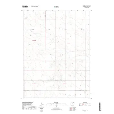
2019 Map of Westplains
USGS Topo · Published 2019About this map
Westplains sits in the northwestern corner of this Logan County landscape, a region defined by its wide, open drainages and a systematic grid of county roads. The terrain is shaped by the subtle erosion of several intermittent waterways, including George Cr, Cedar Cr, and Twomile Cr, which weave through the high plains toward the south and east. Brush Cr cuts across the lower half of the quadrangle, illustrating the drainage patterns typical of this part of Colorado.
Find a feature on this map
18 named features on this map. Tap any name to fly to it.
Don’t see what you’re looking for? This feature index may not catch every label — zoom into the map to look around manually.
Map Details
Editions of this 2019 Westplains Map
This is the sole edition of this map. No revisions or reprints were ever made.
Other maps of this area

1951 · Wild Horse Lake
USGS Topo · 1:24,000

1951 · Atwood NE
USGS Topo · 1:24,000

1954 · Sterling
USGS Topo · 1:250,000

1958 · Sterling
USGS Topo · 1:250,000

1977 · Dipper Spring
USGS Topo · 1:24,000

1977 · Stoneham NE
USGS Topo · 1:24,000

1977 · Avalo SE
USGS Topo · 1:24,000
1978 · Kirchnavy Butte
USGS Topo · 1:24,000
1978 · Chimney Canyons
USGS Topo · 1:24,000
1978 · North Sterling Reservoir
USGS Topo · 1:24,000