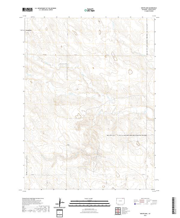
2022 Map of Westplains
USGS Topo · Published 2022About this map
Westplains occupies the northwestern corner of this High Plains landscape in Logan County, characterized by a complex network of intermittent drainage channels. The area's hydrology is defined by seasonal waterways such as George Cr, Cedar Cr, Twomile Cr, and Brush Cr, which carve subtle relief into the flat terrain. This survey illustrates a highly structured ranching or agricultural layout established through a grid of county roads, including the prominent east-west artery of Co RD 58 and north-south connectors like Co RD 9 and Co RD 13. The mapping reflects the enduring Township and Range system, specifically sections within t10n r55w and t10n r54w, where human settlement is concentrated along these surveyed section lines and intersection points.
Find a feature on this map
18 named features on this map. Tap any name to fly to it.
Don’t see what you’re looking for? This feature index may not catch every label — zoom into the map to look around manually.
Map Details
Editions of this 2022 Westplains Map
This is the sole edition of this map. No revisions or reprints were ever made.
Other maps of this area

1951 · Wild Horse Lake
USGS Topo · 1:24,000

1951 · Atwood NE
USGS Topo · 1:24,000

1954 · Sterling
USGS Topo · 1:250,000

1958 · Sterling
USGS Topo · 1:250,000

1977 · Dipper Spring
USGS Topo · 1:24,000

1977 · Stoneham NE
USGS Topo · 1:24,000

1977 · Avalo SE
USGS Topo · 1:24,000
1978 · Kirchnavy Butte
USGS Topo · 1:24,000
1978 · Chimney Canyons
USGS Topo · 1:24,000
1978 · North Sterling Reservoir
USGS Topo · 1:24,000