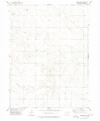
1978 Map of Westplains
USGS Topo · Published 1978About this map
Westplains anchors this High Plains landscape in Logan County, where the topography is defined by the ephemeral drainages of George Creek, Cedar Creek, and Twomile Creek. Surveyed in the late 1970s, the map reveals an economy tied to both the surface and the subsurface, marked by numerous energy and mineral extraction sites. The presence of Oil Wells, a Gas Well, and a Drill Hole across the sections indicates active petroleum exploration during this period, while the Gravel Pit White in the northwest corner highlights local aggregate production. The terrain is characterized by broad draws and the branching paths of Brush Creek, illustrating the natural water management patterns of the Colorado prairie before extensive modern development.
Find a feature on this map
10 named features on this map. Tap any name to fly to it.
Don’t see what you’re looking for? This feature index may not catch every label — zoom into the map to look around manually.
Map Details
Editions of this 1978 Westplains Map
This is the sole edition of this map. No revisions or reprints were ever made.
Other maps of this area

1951 · Wild Horse Lake
USGS Topo · 1:24,000

1951 · Atwood NE
USGS Topo · 1:24,000

1954 · Sterling
USGS Topo · 1:250,000

1958 · Sterling
USGS Topo · 1:250,000

1977 · Dipper Spring
USGS Topo · 1:24,000

1977 · Stoneham NE
USGS Topo · 1:24,000

1977 · Avalo SE
USGS Topo · 1:24,000
1978 · Kirchnavy Butte
USGS Topo · 1:24,000
1978 · Chimney Canyons
USGS Topo · 1:24,000
1978 · North Sterling Reservoir
USGS Topo · 1:24,000