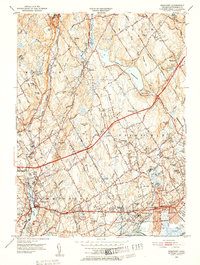
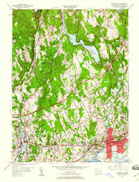
1951 Map of Westport
USGS Topo · Published 1952About this map
The coastal transition of Fairfield County is meticulously detailed here, centered on the Saugatuck River and the expanding suburbs of Westport and Southport. The landscape is a mix of traditional New England landmarks, such as Greenfield Hill Cem and Colonial Cem, and the mid-century infrastructure represented by the Merritt Parkway. The map illustrates a region shifting from a collection of rural hamlets like Lyons Plain and Aspetuck into a refined residential and educational hub, anchored by Fairfield University and several local institutions like the Sherman Sch.
Find a feature on this map
83 named features on this map. Tap any name to fly to it.
Don’t see what you’re looking for? This feature index may not catch every label — zoom into the map to look around manually.
Map Details
Editions of this 1951 Westport Map
5 editions found
Other maps of this area

1889 · Derby
USGS Topo · 1:62,500

1891 · Bridgeport
USGS Topo · 1:62,500

1891 · Derby
USGS Topo · 1:62,500

1892 · Danbury
USGS Topo · 1:62,500

1892 · Norwalk
USGS Topo · 1:62,500

1893 · Bridgeport
USGS Topo · 1:62,500

1893 · Norwalk
USGS Topo · 1:62,500

1893 · Derby
USGS Topo · 1:62,500

1915 · Danbury
USGS Topo · 1:62,500

1920 · Bridgeport
USGS Topo · 1:62,500