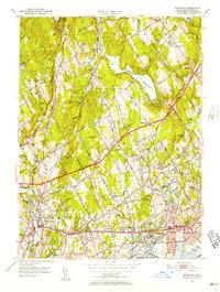
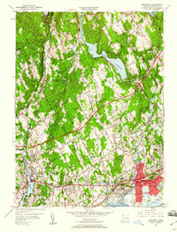
1951 Map of Westport
USGS Topo · Published 1957About this map
The coastal and suburban development of Fairfield County is captured in detail shortly after mid-century, showing the transition from inland farming hamlets to burgeoning shoreline communities. The Boston Post Road and the Merritt Parkway cut across the landscape, framing the growth of Westport and Fairfield as they expand around established institutions like Fairfield University and Ludlowe High Sch. To the north, the terrain remains defined by its water supply infrastructure, dominated by the Hemlock Reservoir, Aspetuck Reservoir, and Saugatuck Reservoir.
Find a feature on this map
61 named features on this map. Tap any name to fly to it.
Don’t see what you’re looking for? This feature index may not catch every label — zoom into the map to look around manually.
Map Details
Editions of this 1951 Westport Map
5 editions found
Other maps of this area

1889 · Derby
USGS Topo · 1:62,500

1891 · Bridgeport
USGS Topo · 1:62,500

1891 · Derby
USGS Topo · 1:62,500

1892 · Danbury
USGS Topo · 1:62,500

1892 · Norwalk
USGS Topo · 1:62,500

1893 · Bridgeport
USGS Topo · 1:62,500

1893 · Norwalk
USGS Topo · 1:62,500

1893 · Derby
USGS Topo · 1:62,500

1915 · Danbury
USGS Topo · 1:62,500

1920 · Bridgeport
USGS Topo · 1:62,500