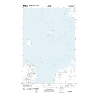
2011 Map of Westport
USGS Topo · Published 2011About this map
Grays Harbor dominates this coastal landscape, where the shifting sands and tidal flats of the Pacific Northwest define the maritime character of the region. The map centers on the protective spit ending at Point Chehalis, which shelters the bustling Westport Marina and the community of Westhaven. This area serves as a critical nautical gateway, evidenced by the presence of the Grays Harbor Coast Guard station and the Westport Airport. To the east, the settlement of Ocosta sits near the mouth of Dempsey Creek, illustrating the coastal development patterns along the southern shores of the harbor.
Find a feature on this map
50 named features on this map. Tap any name to fly to it.
Don’t see what you’re looking for? This feature index may not catch every label — zoom into the map to look around manually.
Map Details
Editions of this 2011 Westport Map
This is the sole edition of this map. No revisions or reprints were ever made.
Other maps of this area

1938 · Moclips
USGS Topo · 1:62,500

1941 · Moclips
USGS Topo · 1:62,500

1941 · Grayland
USGS Topo · 1:62,500

1943 · Humptulips
USGS Topo · 1:62,500

1943 · Copalis Beach
USGS Topo · 1:250,000

1951 · Copalis Beach
USGS Topo · 1:250,000

1953 · Hoquiam
USGS Topo · 1:250,000

1955 · Humptulips
USGS Topo · 1:62,500

1955 · Point Brown
USGS Topo · 1:24,000

1955 · Copalis Beach
USGS Topo · 1:24,000