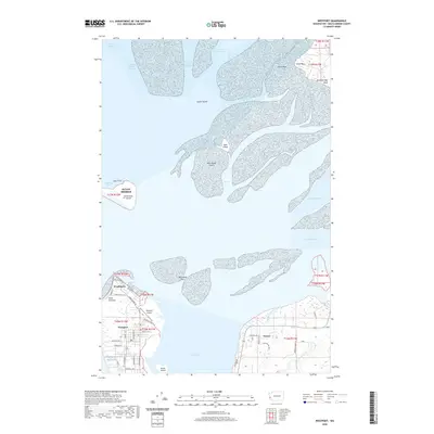
2020 Map of Westport
USGS Topo · Published 2020About this map
Westport and the planned community of Ocean Shores anchor the entrance to Grays Harbor in this 2020 topographical study. The map illustrates the complex hydrography of the region, from the shifting sediment of Sand Island Shoal and Whitcomb Flats to the deep navigation routes of the North Channel and South Channel. The settlement of Westhaven sits at the tip of the peninsula near Point Chehalis, while Ocosta occupies the southern shoreline near Redman Slough.
Find a feature on this map
56 named features on this map. Tap any name to fly to it.
Don’t see what you’re looking for? This feature index may not catch every label — zoom into the map to look around manually.
Map Details
Editions of this 2020 Westport Map
This is the sole edition of this map. No revisions or reprints were ever made.
Other maps of this area

1938 · Moclips
USGS Topo · 1:62,500

1941 · Moclips
USGS Topo · 1:62,500

1941 · Grayland
USGS Topo · 1:62,500

1943 · Humptulips
USGS Topo · 1:62,500

1943 · Copalis Beach
USGS Topo · 1:250,000

1951 · Copalis Beach
USGS Topo · 1:250,000

1953 · Hoquiam
USGS Topo · 1:250,000

1955 · Humptulips
USGS Topo · 1:62,500

1955 · Point Brown
USGS Topo · 1:24,000

1955 · Copalis Beach
USGS Topo · 1:24,000