Loading...
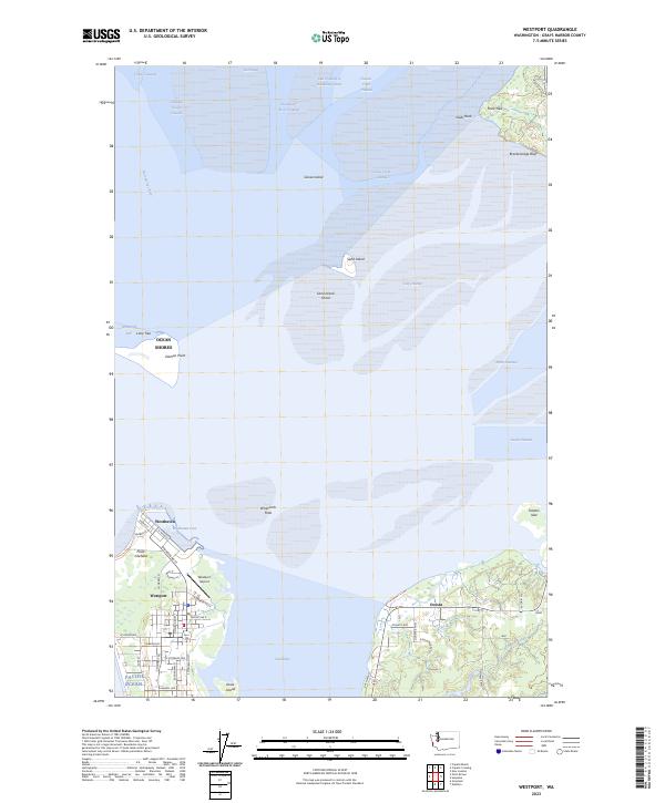
Loading map...2023 Map of Westport
USGS Topo · Published 2023About this map
Westport sits at the northern tip of a peninsula where the Pacific Ocean meets the entrance to Grays Harbor. This coastal landscape is defined by its shifting sands and deep-water channels, including the North Channel and South Channel that bracket Whitcomb Flats. The settlement of Westhaven is centered around Westhaven Cove, a protected harbor area near Point Chehalis, while to the south, the village of Ocosta overlooks the marshy reaches of South Bay.
Find a feature on this map
58 named features on this map. Tap any name to fly to it.
Don’t see what you’re looking for? This feature index may not catch every label — zoom into the map to look around manually.
Map Details
Date Portrayed2023
Date Published2023
PublisherU.S. Geological Survey
Map TypeTopographic
Scale1:24000
Physical Dimensions24 x 29 inches
Editions of this 2023 Westport Map
This is the sole edition of this map. No revisions or reprints were ever made.
Historical Maps of Ocean Shores Through Time
3 maps found
Featured Locations
Source Details
SourceU.S. Geological Survey
CopyrightPublic Domain