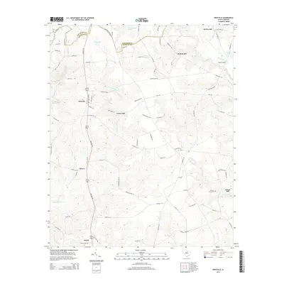
2014 Map of Westville
USGS Topo · Published 2014About this map
The Kershaw Hwy serves as the central spine for this portion of Kershaw County, South Carolina, linking the settlements of Westville, Clyburn, and Dekalb. The landscape is defined by the dense network of tributaries feeding into the Little Lynches River, including Grannies Quarter Cr and Beaverdam Cr. This area maintains its agricultural and industrial heritage through numerous named water features and mills, such as Barfield Mill, Kirkley Mill, and Jordan Mill. Genealogy researchers may find significance in the location of McLeans Branch Cem near the eastern border. The topography is marked by numerous small ridges and ponds, including Lindenmuths Pond and George West Pond, illustrating the hydraulic history of a region where localized milling was once vital to the rural economy.
Find a feature on this map
82 named features on this map. Tap any name to fly to it.
Don’t see what you’re looking for? This feature index may not catch every label — zoom into the map to look around manually.
Map Details
Editions of this 2014 Westville Map
This is the sole edition of this map. No revisions or reprints were ever made.
Other maps of this area

1935 · Camden
USGS Topo · 1:48,000

1938 · Camden
USGS Topo · 1:62,500

1941 · Spartanburg
USGS Topo · 1:250,000

1942 · Camden
USGS Topo · 1:125,000

1953 · Spartanburg
USGS Topo · 1:250,000

1960 · Spartanburg
USGS Topo · 1:250,000

1963 · Spartanburg
USGS Topo · 1:250,000

1964 · Spartanburg
USGS Topo · 1:250,000

1967 · Mount Pisgah
USGS Topo · 1:24,000

1968 · Heath Springs
USGS Topo · 1:24,000