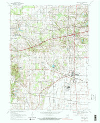
1969 Map of Westville
USGS Topo · Published 1983About this map
Westville serves as a central hub on this Indiana landscape, where the Norfolk and Western and Penn Central rail lines intersect. The map illustrates a significant institutional presence in the region, featuring the large complex of the Beatty Memorial Hospital and the nearby State Prison Farm. These facilities, along with the Township Sch and local cemeteries like Eight Square Cem and Quakerdom Cem, provide a clear picture of the community infrastructure during the late 1960s.
Find a feature on this map
49 named features on this map. Tap any name to fly to it.
Don’t see what you’re looking for? This feature index may not catch every label — zoom into the map to look around manually.
Map Details
Editions of this 1969 Westville Map
2 editions found
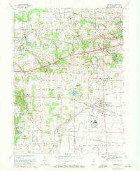
Other maps of this area

1934 · Porter
USGS Topo · 1:48,000

1940 · Porter
USGS Topo · 1:62,500

1953 · Wanatah
USGS Topo · 1:24,000

1953 · Westville
USGS Topo · 1:24,000

1953 · Valparaiso
USGS Topo · 1:24,000

1953 · Chesterton
USGS Topo · 1:24,000

1953 · Dune Acres
USGS Topo · 1:24,000

1953 · Michigan City West
USGS Topo · 1:24,000

1953 · Chicago
USGS Topo · 1:250,000

1957 · Chicago
USGS Topo · 1:250,000