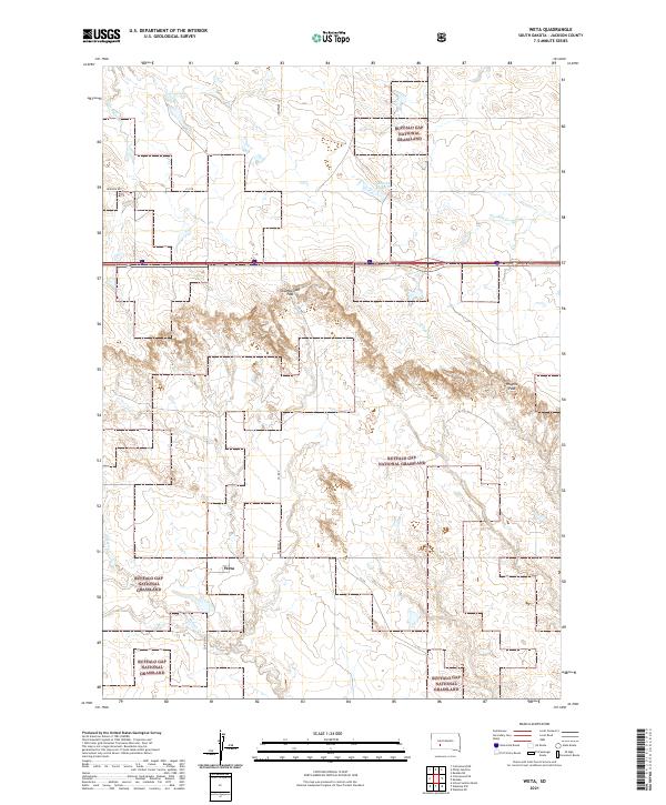
2021 Map of Weta
USGS Topo · Published 2021About this map
Weta sits at the heart of this landscape, a small settlement within the sprawling western South Dakota plains of the Buffalo Gap National Grassland. The topography is defined by the breaks and draws leading toward the White River drainage, marked by geographic transitions like Chamberlain Pass and Hughes Pass. Water is a scarce but vital resource in this semi-arid region, evidenced by the drainage patterns of Little Buffalo Cr, Franklin Cr, and Fifteen Cr. The infrastructure reflects the ranching and agricultural life of Jackson County, with established routes like Fairview Rd and Co Rd 7 connecting isolated homesteads to the village. The inclusion of the Boocke Reservoir highlights the importance of water management in a region where seasonal creeks dictate the rhythm of the land.
Find a feature on this map
17 named features on this map. Tap any name to fly to it.
Don’t see what you’re looking for? This feature index may not catch every label — zoom into the map to look around manually.
Map Details
Editions of this 2021 Weta Map
This is the sole edition of this map. No revisions or reprints were ever made.
Other maps of this area

1950 · Weta
USGS Topo · 1:24,000

1951 · Wanblee NW
USGS Topo · 1:24,000

1951 · School Section Butte
USGS Topo · 1:24,000

1951 · Kadoka
USGS Topo · 1:24,000

1951 · Wanblee NE
USGS Topo · 1:24,000

1953 · Philip Junction
USGS Topo · 1:24,000

1954 · Kadoka NE
USGS Topo · 1:24,000

1955 · Martin
USGS Topo · 1:250,000

1958 · Martin
USGS Topo · 1:250,000

1961 · Cottonwood NE
USGS Topo · 1:24,000