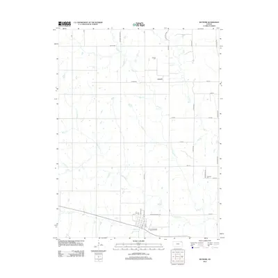
2012 Map of Wetmore
USGS Topo · Published 2012About this map
Wetmore serves as the primary hub in this portion of Nemaha County, defined by its grid of streets including Nebraska St and Section Line St. The landscape is etched by a series of north-south flowing watercourses, notably Muddy Cr, Wolfley Cr, and Craig Cr, which dictate the rural settlement patterns. To the north, the small community of Granada is marked by its namesake Granada Cem and Granada Rd, while the eastern edge of the survey borders the Brown County line. Local transportation is anchored by a network of sectional roads such as Wetmore Sabetha Rd and Antelope Rd. For the genealogist, several burial sites are documented across the landscape, including the Wetmore Cem and the remote Powhattan Cem near the eastern boundary.
Find a feature on this map
35 named features on this map. Tap any name to fly to it.
Don’t see what you’re looking for? This feature index may not catch every label — zoom into the map to look around manually.
Map Details
Editions of this 2012 Wetmore Map
This is the sole edition of this map. No revisions or reprints were ever made.
Other maps of this area

1888 · Hiawatha
USGS Topo · 1:125,000

1894 · Hiawatha
USGS Topo · 1:125,000

1950 · Kansas City
USGS Topo · 1:250,000

1954 · Kansas City
USGS Topo · 1:250,000

1956 · Kansas City
USGS Topo · 1:250,000

1960 · Kansas City
USGS Topo · 1:250,000

1960 · Fairview
USGS Topo · 1:24,000
1960 · Horton NW
USGS Topo · 1:24,000
1961 · Netawaka
USGS Topo · 1:24,000
1961 · Circleville
USGS Topo · 1:24,000