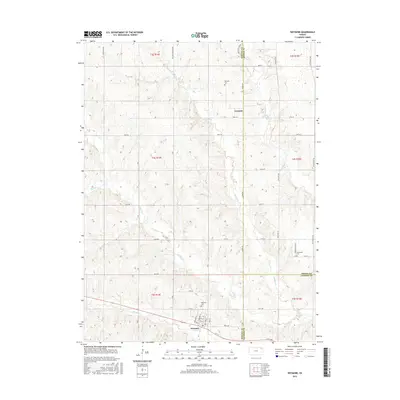
2015 Map of Wetmore
USGS Topo · Published 2015About this map
Wetmore serves as the primary center of activity in this section of northeastern Kansas, situated at the junction of several county lines. The town’s layout is defined by a grid including Iowa St and Minnesota St, with the Wetmore Cem located on the northern outskirts. The landscape is characterized by the branching networks of Spring Cr and Wolfley Cr, which drain the undulating terrain typical of the Nemaha and Jackson County borderlands.
Find a feature on this map
55 named features on this map. Tap any name to fly to it.
Don’t see what you’re looking for? This feature index may not catch every label — zoom into the map to look around manually.
Map Details
Editions of this 2015 Wetmore Map
This is the sole edition of this map. No revisions or reprints were ever made.
Other maps of this area

1888 · Hiawatha
USGS Topo · 1:125,000

1894 · Hiawatha
USGS Topo · 1:125,000

1950 · Kansas City
USGS Topo · 1:250,000

1954 · Kansas City
USGS Topo · 1:250,000

1956 · Kansas City
USGS Topo · 1:250,000

1960 · Kansas City
USGS Topo · 1:250,000

1960 · Fairview
USGS Topo · 1:24,000
1960 · Horton NW
USGS Topo · 1:24,000
1961 · Netawaka
USGS Topo · 1:24,000
1961 · Circleville
USGS Topo · 1:24,000