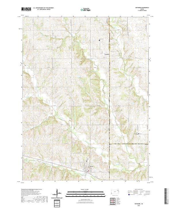
2022 Map of Wetmore
USGS Topo · Published 2022About this map
Wetmore sits at the southern edge of this modern Kansas survey, where a tight grid of streets including Minnesota St and Nebraska St marks the town's residential core. To the north, the small community of Granada is situated near the Nemaha Co Brown Co line. The terrain is defined by the branching drainages of Wolfley Cr, Muddy Cr, and Spring Cr, which carve through the high prairie landscape. Genealogists will find several key burial sites documented, including Wetmore Cem just north of the town limits, Granada Cem to the north, and South Powhattan Cem near the eastern border. The road network remains largely a sectional grid, connected by local routes like Wetmore Sabetha Rd and Acorn Rd, reflecting the enduring agricultural character of this tri-county border region.
Find a feature on this map
51 named features on this map. Tap any name to fly to it.
Don’t see what you’re looking for? This feature index may not catch every label — zoom into the map to look around manually.
Map Details
Editions of this 2022 Wetmore Map
This is the sole edition of this map. No revisions or reprints were ever made.
Other maps of this area

1888 · Hiawatha
USGS Topo · 1:125,000

1894 · Hiawatha
USGS Topo · 1:125,000

1950 · Kansas City
USGS Topo · 1:250,000

1954 · Kansas City
USGS Topo · 1:250,000

1956 · Kansas City
USGS Topo · 1:250,000

1960 · Kansas City
USGS Topo · 1:250,000

1960 · Fairview
USGS Topo · 1:24,000
1960 · Horton NW
USGS Topo · 1:24,000
1961 · Netawaka
USGS Topo · 1:24,000
1961 · Circleville
USGS Topo · 1:24,000