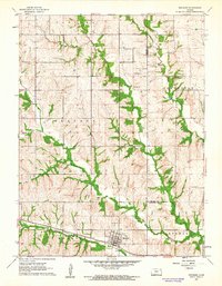
1961 Map of Wetmore
USGS Topo · Published 1962About this map
Wetmore serves as the primary hub of this Northeastern Kansas landscape, situated along the Missouri Pacific railroad corridor. The area is defined by a dense network of waterways, including Wolfley Creek, Muddy Creek, and Spring Creek, which carve through the townships of Capioma, Granada, Powhattan, and Netawaka. The map illustrates a rural economy supported by both agriculture and resource extraction, with several Quarries and Gravel Pits distributed across the terrain.
Find a feature on this map
18 named features on this map. Tap any name to fly to it.
Don’t see what you’re looking for? This feature index may not catch every label — zoom into the map to look around manually.
Map Details
Editions of this 1961 Wetmore Map
This is the sole edition of this map. No revisions or reprints were ever made.
Other maps of this area

1888 · Hiawatha
USGS Topo · 1:125,000

1894 · Hiawatha
USGS Topo · 1:125,000

1950 · Kansas City
USGS Topo · 1:250,000

1954 · Kansas City
USGS Topo · 1:250,000

1956 · Kansas City
USGS Topo · 1:250,000

1960 · Kansas City
USGS Topo · 1:250,000

1960 · Fairview
USGS Topo · 1:24,000
1960 · Horton NW
USGS Topo · 1:24,000
1961 · Netawaka
USGS Topo · 1:24,000
1961 · Circleville
USGS Topo · 1:24,000