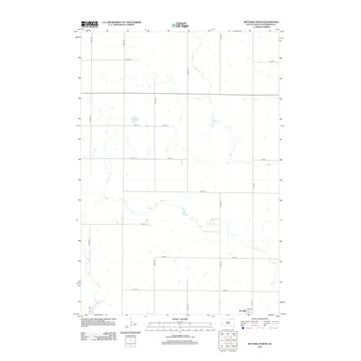
2012 Map of Wetonka North
USGS Topo · Published 2012About this map
Wetonka sits at the southern edge of this prairie landscape, where the township grid meets the meandering paths of Willow Cr and Foot Cr. The terrain is defined by a strictly surveyed network of roads like 366TH Ave and 114th St, which partition the agricultural land of McPherson County into precise sections. In the southwestern corner, Crompton Lake provides a natural break in the geometric regularity of the plains. This 2012 survey illustrates the enduring relationship between the rigid Public Land Survey System and the subtle drainage patterns of the Dakotas, showing how local infrastructure like Heib Ave serves the small community of Wetonka and its surrounding homesteads.
Find a feature on this map
18 named features on this map. Tap any name to fly to it.
Don’t see what you’re looking for? This feature index may not catch every label — zoom into the map to look around manually.
Map Details
Editions of this 2012 Wetonka North Map
This is the sole edition of this map. No revisions or reprints were ever made.
Other maps of this area

1894 · Ellendale
USGS Topo · 1:62,500

1899 · Ellendale
USGS Topo · 1:125,000

1954 · Aberdeen
USGS Topo · 1:250,000

1956 · Aberdeen
USGS Topo · 1:250,000

1968 · Forbes SE
USGS Topo · 1:24,000

1968 · Forbes SW
USGS Topo · 1:24,000
1968 · Frederick SW
USGS Topo · 1:24,000

1970 · Wetonka South
USGS Topo · 1:24,000

1970 · Leola
USGS Topo · 1:24,000
1970 · Richmond SW
USGS Topo · 1:24,000