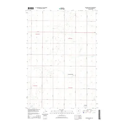
2015 Map of Wetonka North
USGS Topo · Published 2015About this map
Grassland Colony and the nearby village of Wetonka anchor this rural landscape in McPherson County, South Dakota. The topography is defined by the prairie potholes and meandering drainage systems characteristic of this region, with Willow Creek (also labeled Willow Cr) winding through the central and eastern sections. To the south, the waters of Foot Creek and the marshy expanse of Crompton Lake reflect the natural hydrology of the Great Plains.
Find a feature on this map
24 named features on this map. Tap any name to fly to it.
Don’t see what you’re looking for? This feature index may not catch every label — zoom into the map to look around manually.
Map Details
Editions of this 2015 Wetonka North Map
This is the sole edition of this map. No revisions or reprints were ever made.
Other maps of this area

1894 · Ellendale
USGS Topo · 1:62,500

1899 · Ellendale
USGS Topo · 1:125,000

1954 · Aberdeen
USGS Topo · 1:250,000

1956 · Aberdeen
USGS Topo · 1:250,000

1968 · Forbes SE
USGS Topo · 1:24,000

1968 · Forbes SW
USGS Topo · 1:24,000
1968 · Frederick SW
USGS Topo · 1:24,000

1970 · Wetonka South
USGS Topo · 1:24,000

1970 · Leola
USGS Topo · 1:24,000
1970 · Richmond SW
USGS Topo · 1:24,000