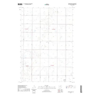
2017 Map of Wetonka North
USGS Topo · Published 2017About this map
Wetonka anchors the southeast corner of this northern McPherson County landscape, situated where the glacial prairie meets a network of vital seasonal drainages. The topography is defined by the winding course of Willow Creek and the southern reach of Foot Cr, which thread through a terrain punctuated by numerous prairie potholes and wetlands characteristic of the James River Valley region. These water features, including Crompton Lake, dictate the rural road grid, which follows section lines established during the early settlement era.
Find a feature on this map
18 named features on this map. Tap any name to fly to it.
Don’t see what you’re looking for? This feature index may not catch every label — zoom into the map to look around manually.
Map Details
Editions of this 2017 Wetonka North Map
This is the sole edition of this map. No revisions or reprints were ever made.
Other maps of this area

1894 · Ellendale
USGS Topo · 1:62,500

1899 · Ellendale
USGS Topo · 1:125,000

1954 · Aberdeen
USGS Topo · 1:250,000

1956 · Aberdeen
USGS Topo · 1:250,000

1968 · Forbes SE
USGS Topo · 1:24,000

1968 · Forbes SW
USGS Topo · 1:24,000
1968 · Frederick SW
USGS Topo · 1:24,000

1970 · Wetonka South
USGS Topo · 1:24,000

1970 · Leola
USGS Topo · 1:24,000
1970 · Richmond SW
USGS Topo · 1:24,000