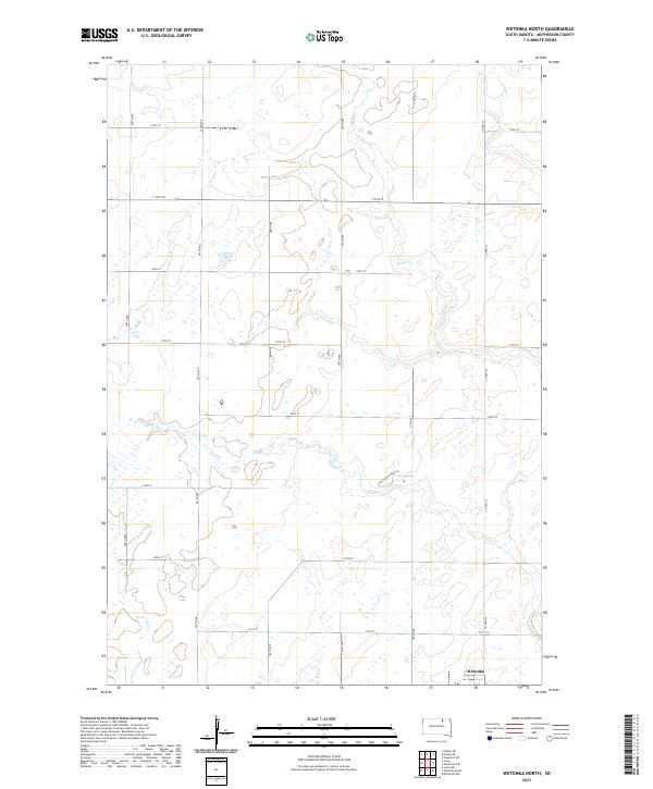
2021 Map of Wetonka North
USGS Topo · Published 2021About this map
Wetonka occupies the southeastern corner of this North Dakota landscape, situated along the intersection of Co Hwy 23 and 121st St. This region of McPherson County is defined by a heavy concentration of prairie potholes and small wetlands, which are scattered across the terrain surrounding Grassland Colony Z. The drainage patterns are established by several winding waterways, including Willow Creek and the smaller Foot Cr, which navigate the subtle elevations of the prairie. The map reflects a structured agricultural grid, where north-south thoroughfares like 366th Ave and 370th Ave divide the land into distinct sections. This 2021 survey documents the persistent rural character of the area, where water management and section-line roads remain the primary influences on the human footprint.
Find a feature on this map
23 named features on this map. Tap any name to fly to it.
Don’t see what you’re looking for? This feature index may not catch every label — zoom into the map to look around manually.
Map Details
Editions of this 2021 Wetonka North Map
This is the sole edition of this map. No revisions or reprints were ever made.
Other maps of this area

1894 · Ellendale
USGS Topo · 1:62,500

1899 · Ellendale
USGS Topo · 1:125,000

1954 · Aberdeen
USGS Topo · 1:250,000

1956 · Aberdeen
USGS Topo · 1:250,000

1968 · Forbes SE
USGS Topo · 1:24,000

1968 · Forbes SW
USGS Topo · 1:24,000
1968 · Frederick SW
USGS Topo · 1:24,000

1970 · Wetonka South
USGS Topo · 1:24,000

1970 · Leola
USGS Topo · 1:24,000
1970 · Richmond SW
USGS Topo · 1:24,000