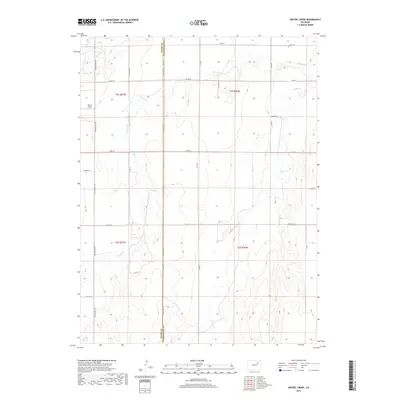
2019 Map of Wetzel Creek
USGS Topo · Published 2019About this map
The high plains of eastern Adams and Washington counties are defined here by a geometric grid of section lines and gravel roads. Wetzel Creek meanders across this landscape, joined by drainage from Badger Creek and Beaver Creek. This 2019 survey shows a region predominantly shaped by agriculture and livestock, where the vast open range is segmented by essential thoroughfares like Meridian Road and Winview Mile Road.
Find a feature on this map
30 named features on this map. Tap any name to fly to it.
Don’t see what you’re looking for? This feature index may not catch every label — zoom into the map to look around manually.
Map Details
Editions of this 2019 Wetzel Creek Map
This is the sole edition of this map. No revisions or reprints were ever made.
Other maps of this area

1954 · Limon
USGS Topo · 1:250,000

1957 · Limon
USGS Topo · 1:250,000

1958 · Limon
USGS Topo · 1:250,000

1973 · Woodrow
USGS Topo · 1:24,000

1973 · Shamrock
USGS Topo · 1:24,000

1973 · Last Chance NW
USGS Topo · 1:24,000
1973 · Woodrow NW
USGS Topo · 1:24,000

1973 · Last Chance
USGS Topo · 1:24,000
1973 · Cottonwood Valley North
USGS Topo · 1:24,000

1973 · Wetzel Creek
USGS Topo · 1:24,000