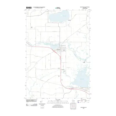
2010 Map of Weyauwega
USGS Topo · Published 2010About this map
Weyauwega serves as the central hub of this Waupaca County landscape, situated where the Waupaca River feeds into Weyauwega Lake. The region's agricultural and rural heritage is evident in the named homesteads and agricultural operations like Evanswood Stock Farm, Sunny Slope Farm, and Elder Lawn Farm, which dot the terrain south of the main settlement. The geography is defined by a dense network of water bodies, including White Lake to the north and the expansive Partridge Lake to the southeast, which is part of the broader Wolf River system near Gills Landing. Local history researchers will find several well-documented burial grounds, such as Oakwood Cemetery and the more remote Butternut Ridge Cemetery, alongside infrastructure like the Weyauwega WP137 Dam that managed the area's vital water resources.
Find a feature on this map
58 named features on this map. Tap any name to fly to it.
Don’t see what you’re looking for? This feature index may not catch every label — zoom into the map to look around manually.
Map Details
Editions of this 2010 Weyauwega Map
This is the sole edition of this map. No revisions or reprints were ever made.
Other maps of this area

1955 · Green Bay
USGS Topo · 1:250,000

1956 · Weyauwega
USGS Topo · 1:48,000

1957 · Waupaca
USGS Topo · 1:48,000

1961 · Poy Sippi
USGS Topo · 1:62,500

1961 · Redgranite
USGS Topo · 1:62,500

1961 · Saxeville
USGS Topo · 1:24,000

1961 · Lake Poygan
USGS Topo · 1:24,000
1961 · Poy Sippi
USGS Topo · 1:24,000

1969 · Readfield
USGS Topo · 1:24,000

1969 · Northport
USGS Topo · 1:24,000