
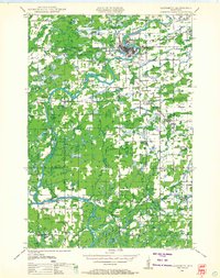
1948 Map of Weyerhauser
USGS Topo · Published 1964About this map
The Minneapolis St Paul and Sault Ste Marie railroad serves as the primary artery for northern Wisconsin commerce in this late 1940s landscape, connecting the bustling villages of Weyerhauser, Bruce, and Apollonia. This map reveals a dense network of one-room schoolhouses such as Pleasant Hill Sch, Soft Maple Sch, and Amacoy Sch, which served the scattered farming communities of Wilkinson and Atlanta townships. The geography is defined by an intricate glacial lake system, featuring major water bodies like Potato Lake and the complex Chain Lake network near the southern border of Rusk Co and Chippewa Co. A rare cultural landmark, the Indian Cem, is noted near Island lake, while the Stang Lookout Tower stands as a sentinel over the heavily wooded terrain of the Stubbs and Rusk districts.
Find a feature on this map
105 named features on this map. Tap any name to fly to it.
Don’t see what you’re looking for? This feature index may not catch every label — zoom into the map to look around manually.
Map Details
Editions of this 1948 Weyerhauser Map
This is the sole edition of this map. No revisions or reprints were ever made.
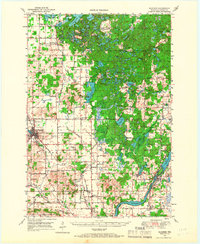
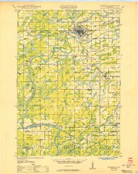
Other maps of this area

1944 · Exeland
USGS Topo · 1:48,000

1945 · Meteor
USGS Topo · 1:48,000

1947 · Exeland
USGS Topo · 1:48,000
1948 · Ladysmith
USGS Topo · 1:48,000

1949 · Meteor
USGS Topo · 1:48,000

1949 · Rice Lake
USGS Topo · 1:48,000
1949 · Bloomer
USGS Topo · 1:62,500

1949 · New Auburn
USGS Topo · 1:62,500

1950 · Weyerhauser
USGS Topo · 1:48,000
1950 · Ladysmith
USGS Topo · 1:48,000