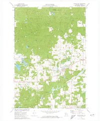
1972 Map of Weyerhauser
USGS Topo · Published 1974About this map
The Wilkinson Hills and Blue Hills dominate the western half of this Rusk County landscape, characterized by dense woodlands and a complex network of glacial kettle lakes and bogs. The village of Weyerhauser serves as the primary settlement, situated at the junction of several local roads and the Soo Line railroad. This transportation corridor was vital for the regional timber and agricultural economy, connecting the remote wetlands to larger markets.
Find a feature on this map
45 named features on this map. Tap any name to fly to it.
Don’t see what you’re looking for? This feature index may not catch every label — zoom into the map to look around manually.
Map Details
Editions of this 1972 Weyerhauser Map
This is the sole edition of this map. No revisions or reprints were ever made.
Other maps of this area

1945 · Meteor
USGS Topo · 1:48,000

1948 · Weyerhauser
USGS Topo · 1:48,000

1949 · Meteor
USGS Topo · 1:48,000

1949 · Rice Lake
USGS Topo · 1:48,000

1950 · Weyerhauser
USGS Topo · 1:48,000

1951 · Rice Lake
USGS Topo · 1:48,000

1951 · Chetek
USGS Topo · 1:62,500

1953 · Rice Lake
USGS Topo · 1:250,000

1959 · Rice Lake
USGS Topo · 1:250,000

1965 · Rice Lake
USGS Topo · 1:62,500