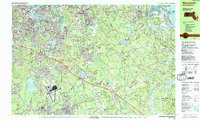
1984 Map of Weymouth
USGS Topo · Published 1984About this map
The South Weymouth Naval Air Station anchors the southern landscape of this 1980s coastal survey, revealing a region defined by established maritime industrial zones and suburban growth. To the north, the Shipyard and Drydocks along the Weymouth Fore River highlight the area's deep-rooted naval and shipbuilding heritage. The terrain transitions from the dense residential grids of Quincy and East Braintree into the expansive woodlands of Wompatuck State Park and the U S Government Reservation. Inland water bodies like Whitmans Pond and Accord Pond provide central landmarks for the surrounding communities of South Weymouth and Accord. The map captures numerous local institutions, from the Maryknoll Seminary to the Old South Burying Ground, alongside the developing transportation corridor of the Bay Colony railroad. Coastal settlements like Cohasset and Minot are shown in detail, including their intricate harbor features and offshore landmarks such as Smith Rocks.
Find a feature on this map
162 named features on this map. Tap any name to fly to it.
Don’t see what you’re looking for? This feature index may not catch every label — zoom into the map to look around manually.
Map Details
Editions of this 1984 Weymouth Map
2 editions found
Other maps of this area

1885 · Abington
USGS Topo · 1:62,500

1885 · Duxbury
USGS Topo · 1:62,500

1886 · Dedham
USGS Topo · 1:62,500

1888 · Duxbury
USGS Topo · 1:62,500

1888 · Abington
USGS Topo · 1:62,500

1892 · Boston Bay
USGS Topo · 1:62,500

1893 · Abington
USGS Topo · 1:62,500

1893 · Boston
USGS Topo · 1:62,500

1893 · Duxbury
USGS Topo · 1:62,500

1894 · Dedham
USGS Topo · 1:62,500