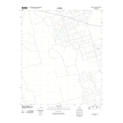
2010 Map of Whalen Lake
USGS Topo · Published 2010About this map
Whalen Lake sits as the central geographic feature of this Andrews County landscape, surrounded by an extensive network of rural roads and energy infrastructure. The 2010 map highlights the significance of the petroleum industry in West Texas, documenting the Block Thirteen Oil Field to the east and the Nix Oil Field to the south. A geometric grid of local routes like SW 7001, SW 450, and SW 7201 connects these industrial areas with larger thoroughfares such as 176 and Ranch Rd 181. This survey provides a clear view of the modern land use patterns in the Permian Basin, where natural water features and intensive resource extraction coexist within a structured ranch-to-market transportation system.
Find a feature on this map
12 named features on this map. Tap any name to fly to it.
Don’t see what you’re looking for? This feature index may not catch every label — zoom into the map to look around manually.
Map Details
Editions of this 2010 Whalen Lake Map
This is the sole edition of this map. No revisions or reprints were ever made.
Other maps of this area

1954 · Hobbs
USGS Topo · 1:250,000

1958 · Hobbs
USGS Topo · 1:250,000

1968 · North Cowden NW
USGS Topo · 1:24,000

1971 · Frankel City
USGS Topo · 1:24,000

1971 · Jumbo Hill
USGS Topo · 1:24,000

1971 · Figure Seven Ranch
USGS Topo · 1:24,000

1971 · Whalen Lake
USGS Topo · 1:24,000

1971 · Frankel City SW
USGS Topo · 1:24,000

1971 · Sand Ranch
USGS Topo · 1:24,000

1971 · Shafter Lake
USGS Topo · 1:24,000