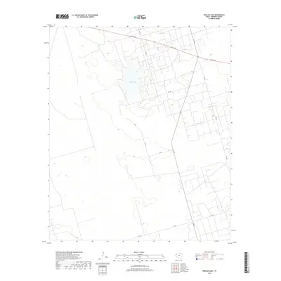
2019 Map of Whalen Lake
USGS Topo · Published 2019About this map
Whalen Lake dominates the central landscape of this West Texas territory, a notable geographic depression in the arid high plains of Andrews County. The surrounding terrain is defined by an extensive grid of local ranch roads and farm-to-market routes that facilitate movement between isolated agricultural and ranching tracts. Significant thoroughfares including Ranch Rd 87 and N Fm 181 intersect in the northeastern quadrant, anchoring the transportation network for the area. The map illustrates a transition between open grazing land and more structured agricultural parcels, evidenced by the intricate network of secondary roads such as SW 450 and SW 560 which reach into the surrounding countryside. This contemporary survey provides a clear view of the modern rural infrastructure and land use patterns typical of the Permian Basin region, where water features like the lake remain essential landmarks.
Find a feature on this map
14 named features on this map. Tap any name to fly to it.
Don’t see what you’re looking for? This feature index may not catch every label — zoom into the map to look around manually.
Map Details
Editions of this 2019 Whalen Lake Map
This is the sole edition of this map. No revisions or reprints were ever made.
Other maps of this area

1954 · Hobbs
USGS Topo · 1:250,000

1958 · Hobbs
USGS Topo · 1:250,000

1968 · North Cowden NW
USGS Topo · 1:24,000

1971 · Frankel City
USGS Topo · 1:24,000

1971 · Jumbo Hill
USGS Topo · 1:24,000

1971 · Figure Seven Ranch
USGS Topo · 1:24,000

1971 · Whalen Lake
USGS Topo · 1:24,000

1971 · Frankel City SW
USGS Topo · 1:24,000

1971 · Sand Ranch
USGS Topo · 1:24,000

1971 · Shafter Lake
USGS Topo · 1:24,000