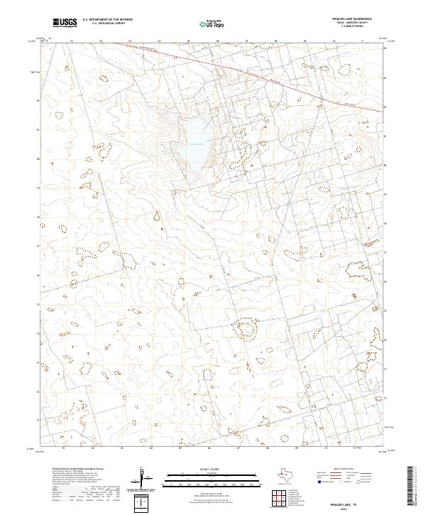
2022 Map of Whalen Lake
USGS Topo · Published 2022About this map
Whalen Lake dominates the central landscape of this West Texas territory, providing a rare hydrological focal point in an area defined by long-distance ranch roads and rural sections. The 2022 survey illustrates a sparse but structured network of infrastructure, where Ranch Rd 87 cuts diagonally across the northern horizon, linking the remote landscape to the broader Andrews County region.
Find a feature on this map
13 named features on this map. Tap any name to fly to it.
Don’t see what you’re looking for? This feature index may not catch every label — zoom into the map to look around manually.
Map Details
Editions of this 2022 Whalen Lake Map
This is the sole edition of this map. No revisions or reprints were ever made.
Other maps of this area

1954 · Hobbs
USGS Topo · 1:250,000

1958 · Hobbs
USGS Topo · 1:250,000

1968 · North Cowden NW
USGS Topo · 1:24,000

1971 · Frankel City
USGS Topo · 1:24,000

1971 · Jumbo Hill
USGS Topo · 1:24,000

1971 · Figure Seven Ranch
USGS Topo · 1:24,000

1971 · Whalen Lake
USGS Topo · 1:24,000

1971 · Frankel City SW
USGS Topo · 1:24,000

1971 · Sand Ranch
USGS Topo · 1:24,000

1971 · Shafter Lake
USGS Topo · 1:24,000