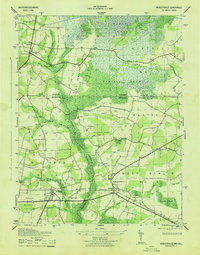
1943 Map of Whaleysville
USGS Topo · Published 1943About this map
The Pocomoke River carves through the center of this 1943 survey, defining a landscape of sprawling wetlands and small agricultural communities on the Maryland-Delaware border. The massive Cypress Swamp dominates the northern reaches, including the distinct terrain of Newfound Neck and Big Newfound Neck. These swampy lowlands necessitated extensive drainage projects, visible here as the Old Ditch Line, Davis Ditch, and Bellfield Ditch, which helped make the surrounding land viable for farming.
Find a feature on this map
56 named features on this map. Tap any name to fly to it.
Don’t see what you’re looking for? This feature index may not catch every label — zoom into the map to look around manually.
Map Details
Editions of this 1943 Whaleysville Map
This is the sole edition of this map. No revisions or reprints were ever made.
Other maps of this area

1901 · Ocean City
USGS Topo · 1:62,500

1902 · Pittsville
USGS Topo · 1:62,500

1917 · Millsboro
USGS Topo · 1:62,500

1918 · Rehoboth
USGS Topo · 1:62,500

1938 · Millsboro
USGS Topo · 1:62,500

1938 · Rehoboth
USGS Topo · 1:62,500

1942 · Ocean City
USGS Topo · 1:62,500

1942 · Ninepin
USGS Topo · 1:24,000

1942 · Wango
USGS Topo · 1:24,000

1942 · Whaleysville
USGS Topo · 1:24,000