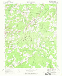
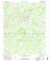
1967 Map of Whaleyville
USGS Topo · Published 1969About this map
Whaleyville sits at the heart of this coastal plain landscape, where the agricultural uplands of Virginia give way to the dense, water-logged basins of the North Carolina borderlands. The terrain is defined by a series of interconnected swamp systems, including Spivey Swamp and Duke Swamp, which flow toward the Black Mingle Pocosin in the south. This low-lying topography dictated the path of the Seaboard Coast Line railroad, which skirts the wetland edges and connects smaller clusters like Drum Hill and Willeyton.
Find a feature on this map
36 named features on this map. Tap any name to fly to it.
Don’t see what you’re looking for? This feature index may not catch every label — zoom into the map to look around manually.
Map Details
Editions of this 1967 Whaleyville Map

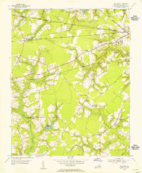
Other maps of this area

1906 · Beckford
USGS Topo · 1:48,000

1907 · Beckford
USGS Topo · 1:62,500

1908 · Winton
USGS Topo · 1:62,500

1919 · Suffolk
USGS Topo · 1:62,500

1920 · Holland
USGS Topo · 1:62,500

1940 · Beckford
USGS Topo · 1:62,500

1943 · Holland
USGS Topo · 1:62,500

1953 · Norfolk
USGS Topo · 1:250,000
1954 · Buckhorn
USGS Topo · 1:24,000

1954 · Corapeake
USGS Topo · 1:24,000