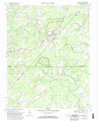
1967 Map of Whaleyville
USGS Topo · Published 1981About this map
The borderlands of the Virginia North Carolina line are defined by an intricate network of wetlands, including the extensive Duke Swamp and Spivey Swamp. Centered on the town of Whaleyville, the landscape shows a transition from agricultural clearings to the dense, low-lying thickets of the Black Mingle Pocosin and Hall Pocosin. The infrastructure of the era is anchored by numerous rural landmarks such as the Jones Sch and Great Fork Ch, which served established communities like Somerton and Whaley.
Find a feature on this map
38 named features on this map. Tap any name to fly to it.
Don’t see what you’re looking for? This feature index may not catch every label — zoom into the map to look around manually.
Map Details
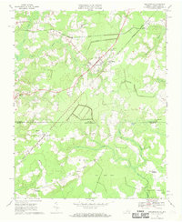
Editions of this 1967 Whaleyville Map

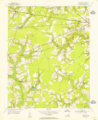
Other maps of this area

1906 · Beckford
USGS Topo · 1:48,000

1907 · Beckford
USGS Topo · 1:62,500

1908 · Winton
USGS Topo · 1:62,500

1919 · Suffolk
USGS Topo · 1:62,500

1920 · Holland
USGS Topo · 1:62,500

1940 · Beckford
USGS Topo · 1:62,500

1943 · Holland
USGS Topo · 1:62,500

1953 · Norfolk
USGS Topo · 1:250,000
1954 · Buckhorn
USGS Topo · 1:24,000

1954 · Corapeake
USGS Topo · 1:24,000