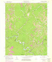
1963 Map of Wharncliffe
USGS Topo · Published 1979About this map
The Tug Fork carves a serpentine path through the Central Appalachian coalfields, forming a natural boundary where West Virginia meets Kentucky and Virginia. This area is defined by its deep creek valleys and the Norfolk and Western railway, which follows the river's bends to serve mining operations and the scattered settlements of the hollows. Small communities like Wharncliffe and War Eagle are clustered near the tracks and riverbank, while the upland reaches of Stafford Mountain and Sandy Ridge are marked by extensive mines and ridgeline infrastructure like a prominent pipeline.
Find a feature on this map
64 named features on this map. Tap any name to fly to it.
Don’t see what you’re looking for? This feature index may not catch every label — zoom into the map to look around manually.
Map Details
Editions of this 1963 Wharncliffe Map
3 editions found
Other maps of this area

1886 · Grundy
USGS Topo · 1:125,000

1887 · Warfield
USGS Topo · 1:125,000

1890 · Grundy
USGS Topo · 1:125,000

1891 · Tazewell
USGS Topo · 1:125,000

1891 · Oceana
USGS Topo · 1:125,000

1891 · Warfield
USGS Topo · 1:125,000

1892 · Grundy
USGS Topo · 1:125,000

1893 · Oceana
USGS Topo · 1:125,000

1895 · Tazewell
USGS Topo · 1:125,000

1897 · Tazewell
USGS Topo · 1:125,000