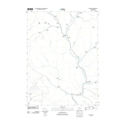
2010 Map of Wharton
USGS Topo · Published 2010About this map
First Fork Sinnemahoning Creek serves as the primary drainage through this stretch of Potter County, where the small settlements of Costello and Wharton anchor a landscape defined by deep, naming-rich hollows. The confluence of Freeman Run at Costello reveals a pattern of historic development along the valley floor, supported by several local burial grounds including Saint Joseph Cemetery and Costello Cemetery. The topography is marked by numerous family-named and descriptive landforms like Kirkendahl Hollow, Big Carlson Hollow, and Railroad Hollow, the latter hinting at the area's industrial past. A notable legacy of the region's early river management can be found in the Splash Dam located near Brainard Hollow, while Wharton Cemetery sits near the southern end of the sheet, providing a geographic record of the families who settled this timber and water-rich corridor.
Find a feature on this map
65 named features on this map. Tap any name to fly to it.
Don’t see what you’re looking for? This feature index may not catch every label — zoom into the map to look around manually.
Map Details
Editions of this 2010 Wharton Map
This is the sole edition of this map. No revisions or reprints were ever made.
Other maps of this area

1945 · Driftwood
USGS Topo · 1:48,000

1945 · First Fork
USGS Topo · 1:24,000

1945 · Cameron
USGS Topo · 1:24,000

1946 · Renovo West
USGS Topo · 1:62,500

1946 · Hammersley Fork
USGS Topo · 1:24,000

1947 · Cameron
USGS Topo · 1:24,000

1947 · First Fork
USGS Topo · 1:24,000

1947 · Conrad
USGS Topo · 1:62,500

1947 · Conrad
USGS Topo · 1:24,000

1947 · Ayers Hill
USGS Topo · 1:24,000
Featured Places
- Wharton Township, PA
- Costello, Portage Township
- Lumber Township, PA
- Portage Township, PA
- Grove Township, PA