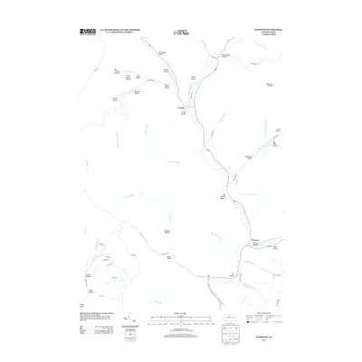
2013 Map of Wharton
USGS Topo · Published 2013About this map
The winding course of the First Fork Sinnemahoning Cr serves as the central artery for this region of Potter County, where the small settlements of Wharton and Costello are situated along the valley floor. The landscape is defined by a dense network of tributary runs and hollows, such as Fish Basket Hollow and Bentley Hollow, which branch out from the main waterway. The names preserved on this 2013 survey often reflect historical land use and early infrastructure, including Railroad Hollow, Schoolhouse Hollow, and Gas Well Hollow. These labels suggest a legacy of timbering, education, and early resource extraction that shaped these narrow valleys. High ridges separated by deep drainages like Bailey Run and Little Portage Cr create a pattern of isolated settlements connected by a limited network of mountain roads.
Find a feature on this map
66 named features on this map. Tap any name to fly to it.
Don’t see what you’re looking for? This feature index may not catch every label — zoom into the map to look around manually.
Map Details
Editions of this 2013 Wharton Map
This is the sole edition of this map. No revisions or reprints were ever made.
Other maps of this area

1945 · Driftwood
USGS Topo · 1:48,000

1945 · First Fork
USGS Topo · 1:24,000

1945 · Cameron
USGS Topo · 1:24,000

1946 · Renovo West
USGS Topo · 1:62,500

1946 · Hammersley Fork
USGS Topo · 1:24,000

1947 · Cameron
USGS Topo · 1:24,000

1947 · First Fork
USGS Topo · 1:24,000

1947 · Conrad
USGS Topo · 1:62,500

1947 · Conrad
USGS Topo · 1:24,000

1947 · Ayers Hill
USGS Topo · 1:24,000
Featured Places
- Wharton Township, PA
- Costello, Portage Township
- Lumber Township, PA
- Portage Township, PA
- Grove Township, PA