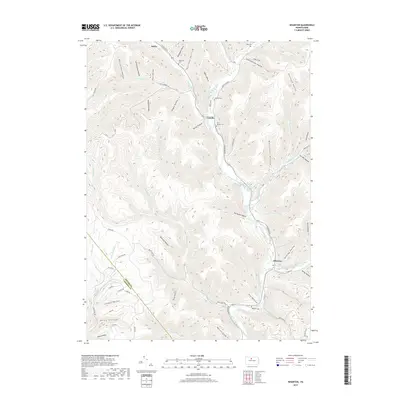
2019 Map of Wharton
USGS Topo · Published 2019About this map
First Fork Sinnemahoning Creek carves a deep valley through this portion of Potter County, serving as the central artery for the settlements of Costello and Wharton. This landscape is defined by an intricate network of narrow hollows and runs, such as Schoolhouse Hollow and Railroad Hollow, which illustrate the historical reliance on these natural corridors for transport and settlement. Genealogy researchers will find significant value in the numerous burial sites documented across the terrain, including Costello Cem, Saint Joseph Cem, and the more isolated Rees Cem near the northern boundary. The junction of the East Fork with the main branch at Wharton highlights the traditional importance of these river confluences. Further south, the Potter Co and Cameron Co boundary line crosses the rugged peaks, passing near landmarks like Barrett Slide and Colbert Hollow.
Find a feature on this map
78 named features on this map. Tap any name to fly to it.
Don’t see what you’re looking for? This feature index may not catch every label — zoom into the map to look around manually.
Map Details
Editions of this 2019 Wharton Map
This is the sole edition of this map. No revisions or reprints were ever made.
Other maps of this area

1945 · Driftwood
USGS Topo · 1:48,000

1945 · First Fork
USGS Topo · 1:24,000

1945 · Cameron
USGS Topo · 1:24,000

1946 · Renovo West
USGS Topo · 1:62,500

1946 · Hammersley Fork
USGS Topo · 1:24,000

1947 · Cameron
USGS Topo · 1:24,000

1947 · First Fork
USGS Topo · 1:24,000

1947 · Conrad
USGS Topo · 1:62,500

1947 · Conrad
USGS Topo · 1:24,000

1947 · Ayers Hill
USGS Topo · 1:24,000
Featured Places
- Wharton Township, PA
- Costello, Portage Township
- Lumber Township, PA
- Portage Township, PA
- Grove Township, PA