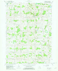
1962 Map of Wheatland
USGS Topo · Published 1982About this map
Glacial topography defines the intersection of several townships in Hillsdale County, where the headwaters of major drainage systems originate. The South Br Kalamazoo R flows from the northwest, while St Joseph Creek and its tributaries carve through the southern sections. This landscape is a patchwork of small agricultural holdings and wetlands, dotted with woodlots and modest water bodies like Williams Lake and Mercer Lakes.
Find a feature on this map
40 named features on this map. Tap any name to fly to it.
Don’t see what you’re looking for? This feature index may not catch every label — zoom into the map to look around manually.
Map Details
Editions of this 1962 Wheatland Map
2 editions found
Other maps of this area

1935 · Jackson
USGS Topo · 1:48,000

1939 · Jackson
USGS Topo · 1:62,500

1948 · Spring Arbor
USGS Topo · 1:62,500

1949 · Spring Arbor
USGS Topo · 1:62,500

1953 · Fort Wayne
USGS Topo · 1:250,000

1956 · Fort Wayne
USGS Topo · 1:250,000

1958 · Grand Rapids
USGS Topo · 1:250,000

1959 · North Adams
USGS Topo · 1:24,000

1959 · Frontier
USGS Topo · 1:24,000

1961 · Grand Rapids
USGS Topo · 1:250,000