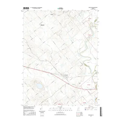
2016 Map of Wheatland
USGS Topo · Published 2016About this map
The town of Wheatland serves as the central hub of this Knox County landscape, situated where the CSX railroad and several regional routes converge. The terrain is defined by a sophisticated network of drainage and water management, featuring named channels like Steen Ditch, Roberson Ditch, and Patrick Ditch that weave through the farmland. To the east, the White River forms a natural boundary with Daviess County, creating a distinct riparian zone marked by Hyatt Island and several water bodies including Weaver Pond and Clear Pond.
Find a feature on this map
95 named features on this map. Tap any name to fly to it.
Don’t see what you’re looking for? This feature index may not catch every label — zoom into the map to look around manually.
Map Details
Editions of this 2016 Wheatland Map
This is the sole edition of this map. No revisions or reprints were ever made.
Other maps of this area

1942 · Fritchton
USGS Topo · 1:24,000

1943 · Oaktown
USGS Topo · 1:24,000

1943 · Bicknell
USGS Topo · 1:24,000

1943 · Plainville
USGS Topo · 1:24,000

1944 · Fritchton
USGS Topo · 1:24,000

1944 · Washington
USGS Topo · 1:24,000

1944 · Monroe City
USGS Topo · 1:24,000

1944 · Wheatland
USGS Topo · 1:24,000

1944 · Iona
USGS Topo · 1:24,000

1945 · Sandy Hook
USGS Topo · 1:24,000