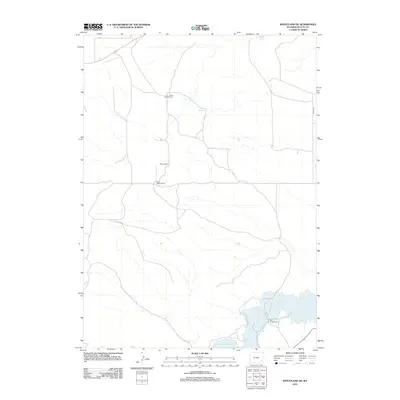
2012 Map of Wheatland NE
USGS Topo · Published 2012About this map
Grayrocks Reservoir dominates the southeast corner of this Platte County landscape, a vital water source in this high plains environment. The terrain is marked by family-run agricultural operations, reflecting a persistent ranching heritage in Wyoming. Several distinct homesteads are identified, including the Paul Cundall Ranch and the nearby Don Cundall Ranch, alongside the Milton Ranch and Clair Milton Ranch. Natural water sources like Warm Springs and Box Springs dot the drainage patterns that feed toward the reservoir, while Battle Rd provides a primary transit corridor through the eastern edge of the quadrangle. This 2012 survey illustrates the intersection of modern water management and traditional western land use.
Find a feature on this map
8 named features on this map. Tap any name to fly to it.
Don’t see what you’re looking for? This feature index may not catch every label — zoom into the map to look around manually.
Map Details
Editions of this 2012 Wheatland NE Map
This is the sole edition of this map. No revisions or reprints were ever made.
Other maps of this area

1896 · Hartville
USGS Topo · 1:125,000

1901 · Hartville
USGS Topo · 1:125,000

1950 · Guernsey
USGS Topo · 1:24,000

1950 · Herman Ranch
USGS Topo · 1:24,000

1950 · Register Cliff
USGS Topo · 1:24,000

1950 · Guernsey Reservoir
USGS Topo · 1:24,000

1951 · Guernsey Reservoir
USGS Topo · 1:24,000
1951 · Herman Ranch
USGS Topo · 1:24,000

1951 · Dwyer
USGS Topo · 1:24,000

1951 · Antelope Gap
USGS Topo · 1:24,000