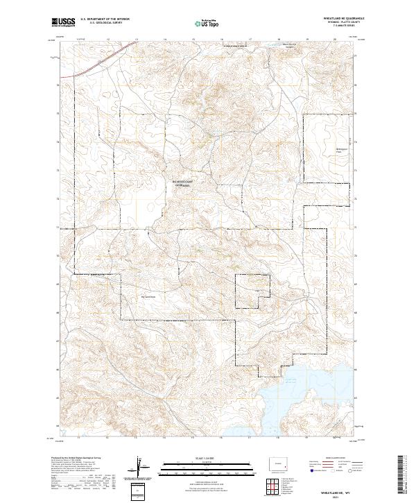
2021 Map of Wheatland NE
USGS Topo · Published 2021About this map
Grayrocks Reservoir dominates the southeastern corner of this map, reflecting the mid-twentieth century water management strategies that shaped the arid high plains of Wyoming. This 2021 survey documents the topography of the Laramie River drainage area, where seasonal watercourses like Big Sand Draw and local water sources such as Box Springs have historically dictated the patterns of ranching and settlement. The landscape transitions from the open plains of Bettelyoun Flats to the more varied terrain around Warm Springs Canyon, where the presence of Warm Springs indicates the geothermal activity characteristic of this region.
Find a feature on this map
12 named features on this map. Tap any name to fly to it.
Don’t see what you’re looking for? This feature index may not catch every label — zoom into the map to look around manually.
Map Details
Editions of this 2021 Wheatland NE Map
This is the sole edition of this map. No revisions or reprints were ever made.
Other maps of this area

1896 · Hartville
USGS Topo · 1:125,000

1901 · Hartville
USGS Topo · 1:125,000

1950 · Guernsey
USGS Topo · 1:24,000

1950 · Herman Ranch
USGS Topo · 1:24,000

1950 · Register Cliff
USGS Topo · 1:24,000

1950 · Guernsey Reservoir
USGS Topo · 1:24,000

1951 · Guernsey Reservoir
USGS Topo · 1:24,000
1951 · Herman Ranch
USGS Topo · 1:24,000

1951 · Dwyer
USGS Topo · 1:24,000

1951 · Antelope Gap
USGS Topo · 1:24,000